Underground Utility Detection Surveys
We use highly experienced teams of surveyors with diverse technical backgrounds and industry experience ti deliver the highest standard of underground utility detection surveys.
Our team deliver a prompt, efficient and consistently competitive service for all your Utility, Drainage & Surveying needs.
Our underground utility survey services include:
- Underground utility detection and mapping
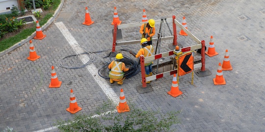
- Electronic trail holes surveys
- Drainage connectivity surveys
- Ground penetrating radar surveys
What is an underground utility survey?
An underground utility survey determines the location and position of conductive and non-conductive services using ground penetrating radar and electromagnetic instruments.
What are the benefits of performing a utility survey?
Accurate identification of utilities can reduce the risk of costly damage to underground services, dangerous accidents and time-consuming call outs. In addition, utility surveys provide your business with a map of the location of utility assets and buried objects for future reference, for example, in the event of repair or replacement of buried services.
When is underground utility survey mapping necessary?
Having accurate underground utility data is essential before any development project. Drawings provided by utility companies are not always accurate, so it is imperative to have your own set of survey data obtained by experienced personnel.
Underground utility detection surveys can inform:
- New construction and renovation projects
- Utility repairs and upgrades
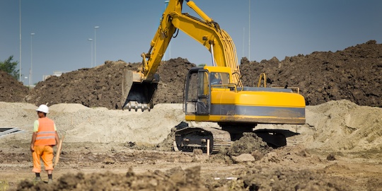
- Excavations and trenching work
- Remediation work
- Landscaping developments
Who can perform utility surveys?
Three things are required to complete an underground utility survey: the right equipment, highly skilled individuals and a clear understanding of all necessary safety procedures. At SEP, we have all three at our disposal.
What are the risks of not performing utility surveys?
If a survey is not performed before a development project, there can be severe consequences both in terms of health and safety and the overall project cost. Rectifying any damage to utilities caused by development can prove extremely costly. There are inevitably some unknowns in any development project, but one can never afford to ignore the possibility of existing utilities.
What underground utilities can be mapped?
Utility investigation services may cover the following:
- Water pipelines
- Electricity cables
- Oil and Gas pipelines
- Drainage and sewage pipelines
- Telecommunications and fibre optics cables
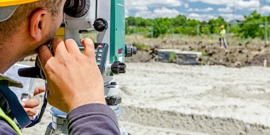
What equipment does a utility surveyor use?
Underground utility detection equipment is typically either based on GPR or electromagnetic location technology. GPR units are used to detect underground utilities, objects and hidden structures that may be covered by a shallow layer of soil. Electromagnetic locating equipment can be either use active or passive technology to detect changes in electromagnetic fields.


How does Ground Penetrating Radar (GPR) work?
GPR can be used for underground utility surveys, locating buried structures/objects/sewers, water lines, drainage systems, building foundations and retaining walls. An antenna sends out an electromagnetic signal that penetrates the ground surface and reflects back to the receiver. The reflected signal is then analysed to determine the presence of utility lines, voids and other objects under the surface.
How accurate is the data from a utility mapping survey?
Compared to a topographical survey, underground utility mapping is an inexact science. The final results are dependent on factors such as depth of utilities, the composition of surrounding materials, soil type and the quality of the equipment used. While it is impossible to guarantee 100% accuracy in any survey that uses non-invasive techniques, our skilled personnel are well-equipped to minimise inaccuracies.
What are the data outputs from an underground utility mapping survey?
The data from underground utility surveys can be presented in a variety of ways but is typically supplied as a drawing and report.
Health and safety regulation for underground mapping
Underground utility surveys work must be conducted by individuals who are properly trained and qualified to do so. Our skilled team at SEP have the training, qualifications and experience necessary to perform any underground mapping survey.


How much do underground utility mapping surveys cost?
The cost of utility surveys varies depending on the scale of the project, length of survey and location.
For a detailed price estimate, please contact us.
Get a utility survey quote
SEP has extended the utility services section of the business to incorporate the needs of our clients and has branched out into deep ground penetrating surveys. This type of survey supports our surveyor’s investigations in locating geological faults, mine shafts, voids and deep utility services. We provide a wide range of underground services from a mark out to full mapping and drainage.
Supported by our in-house CAD & BIM technicians, SEP provides a single point of contact for all your utility and topographical survey requirements.
For more information on our underground utility mapping services or to get a quote for your project, contact our team at SEP.


