SEP Enhances Survey Capabilities with the Advanced Hovermap LiDAR System
Posted 21 March 2024
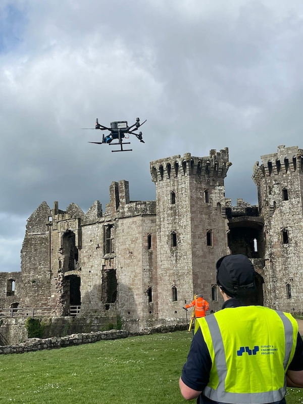
Survey & Engineering Projects (SEP) is excited to announce the acquisition of a Hovermap LiDAR system, delivering precise and detailed data for surveying and inspection services.
Using SLAM (Simultaneous Localisation and Mapping) technology, the award-winning Hovermap system can accurately map complex environments in real time where GPS is often unavailable. This is a critical feature when conducting surveys or inspections in challenging areas such as in dense forests, underground structures, or inside large industrial complexes. SLAM allows these areas to be mapped with centimetre-level accuracy, providing clients with highly detailed and accurate data for their projects.
This versatile system can be adapted to a wide array of deployment methods, ensuring thorough and accurate data collection in virtually any environment. Whether attached to a drone, a vehicle, or used manually on foot, the Hovermap system provides exceptional flexibility and adaptability for surveying and inspection projects.
The system's adaptability also allows it to be used for a variety of applications, including infrastructure inspection, forestry mapping, and even search and rescue missions. Hovermap also offers advanced features such as automated flight planning, collision avoidance, and real-time data visualisation. This not only streamlines the data collection process but also enhances safety for surveyors and operators.
Mark Hayes, Director at Survey & Engineering Projects, said:
"We are excited to add the Hovermap system to our suite of surveying and inspection tools. This advanced system gives us unprecedented access to areas that were previously considered inaccessible or too dangerous to survey in person. With the ability to map these areas in real time and with pinpoint accuracy, we can now provide our clients with even more comprehensive data for their projects."
SEP's investment in Hovermap reflects their commitment to continuously improving and expanding their services to meet the evolving needs of their clients.
For more information on SEP's services and the new Hovermap system, please visit www.sepsurvey.com.
Related Pages: Drone/UAV Surveys


